23 Jul 2018 Exploring the Tollantusky Trail
by Fred Petrucelli
It is a gorgeous and captivating piece of wilderness that is largely forgotten by most people.
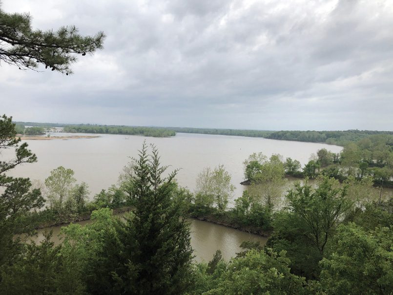
Only five miles west of Conway, the Tollantusky Trail offers vistas of commanding beauty along the Arkansas River. It is named for Tollantusky, a distinguished chief of the Arkansas Cherokees who arrived here from Tennessee in 1809.
It is believed that the chief lived in the area where Cadron Settlement Park is located until 1817. From there, he traveled extensively, at times going to Washington, D.C., to affix his signature to treaties with the U.S. government.

Tollantusky died in 1818, 15 years before the infamous Trail of Tears in which his people were forcibly moved across Arkansas and relocated in Oklahoma Indian Territory.
The Faulkner County Historical Society writes that the meandering Tollantusky Trail was established by the U.S. Corps of Engineers as a memorial to the noted Indian chief. It measures 7,500 feet in walking time. In effect, it is a leisurely 45 minutes with rest stops.
The trail’s beauty is enhanced by pastoral scenes and a panorama of natural, breathtaking views that give notice of its wonder.
As the trail begins, the visitor finds himself on an eroded road bed that carried coaches of the old Butterfield Stage Line, which listed Cadron as a regular station on the mail route from Memphis to San Francisco.
Historical findings from the Faulkner Historical Society note that at the crest of the first hill of the Tollantusky Trail, the Harris Family is buried in six or seven unidentified graves, including the Army lieutenant who traveled with the Native Americans on the Trail of Tears.
From the cemetery, the trail continues to the bluff of the north ridge and affords an excellent view of the Arkansas River. Huge red cedars — some old enough to date back to the time of the Cadron Settlement — and a variety of vegetation (moss, ferns honeysuckle, dogwood) can be seen while walking the trail.
The next stop is Vista Point, another scenic spot above the river bluff. A short climb along the trail to the crest of the ridge leads to an outcropping of moss and lichen rocks. The trail extends along the ridge again to the river bluff where the elevation is some 375 feet above sea level. This is almost 100 feet higher than the trail’s beginning, although the change is gradual.
The stage road is again briefly encountered as the trail leads past the north ridge parking lot along the north slope. A short side spur on the eastern end of the slope provides a path to one of the original U.S. government survey points established in the area.
The trail continues across the crest of the North Ridge Road near the well pump, picnic tables and restrooms. It makes a long, winding descent and curves along a deep gully to a low water, native stone bridge, which spans the ravine at the Old Grist Mill site, and ends the trail at the entrance parking lot.
Information about historical points of interest along the trail was provided by the Faulkner County Historical Society and the Conway Area Chamber of Commerce.


