
28 Feb 2023 Drones helping farmers make field inspections easier and faster
By Judy Riley
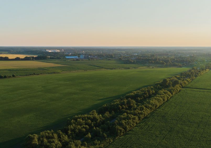
It’s a bird. It’s a plane. Could it be a drone? Absolutely! Drones flying over fields in Central Arkansas are more and more common.
Drones have historically been used in weather reports, real estate photos and military applications. More recently, drones have become a big deal in Arkansas agriculture. As agriculture practices continue to evolve, producers are looking for new and exciting ways to increase their yields while also conserving resources and limiting their impact on the environment. Drones are one of many technological tools farmers use to evaluate and care for their crops and animals.
Drones are the latest wave in a series of applications broadly referred to as tools in precision agriculture. “Precision ag includes use of several computer systems: global position system (GPS), geographic information systems, real-time kinematic positioning and normalized difference vegetation index,” said Lee Riley, program associate with the University of Arkansas System Division of Agriculture (UADA). What does that mean in lay terms? Farmers manage irrigation, pinpointing areas that are getting too much or too little water. They identify small areas of a field that are not growing properly, needing more fertilizer, or assessing the level of insect or weed infestations. And they do all that from the edge of the field with their drone’s data sent to a computer. They basically “stitch” together the drone’s photographs to make visual topical maps.
The obvious benefit is saving time. “My drone photographs allow me to make decisions without having to physically walk my fields,” said Matt Morris, a rice, corn and soybean farmer from Carlisle. “My dad and I farm over 1,200 acres and we can do that quicker and more accurately. I feel like I am carrying on my family’s legacy using the latest technology. My great-great-grandfather was the first farmer to bring rice production to Arkansas in 1897. He was an innovator and my family has been since. Part of the land we farm includes his original 30 acres, still in rice production today.”
“Whole field inspection is often difficult and laborious,” said Dr. Jason Davis, application technologist with UADA. “The aerial perspective of an entire field via drone makes those inspections easier and faster. Additionally, the processing of field imagery can help make decisions in optimizing dirt work and irrigation planning from season to season.”
Farmers use the term “input costs” when evaluating their bottom line. That includes the cost of seeds, fertilizers, chemicals for weed and insect control, water, fuel and electricity to pump water. Because of mapping provided by drones, farmers can select certain plants that might need more fertilizer or spots of insects or disease that need chemicals, saving chemical use and the cost of applying it. Water is a huge necessity for any crop, especially rice. Protecting and conserving as much water as possible reduces the cost of energy for pumping.
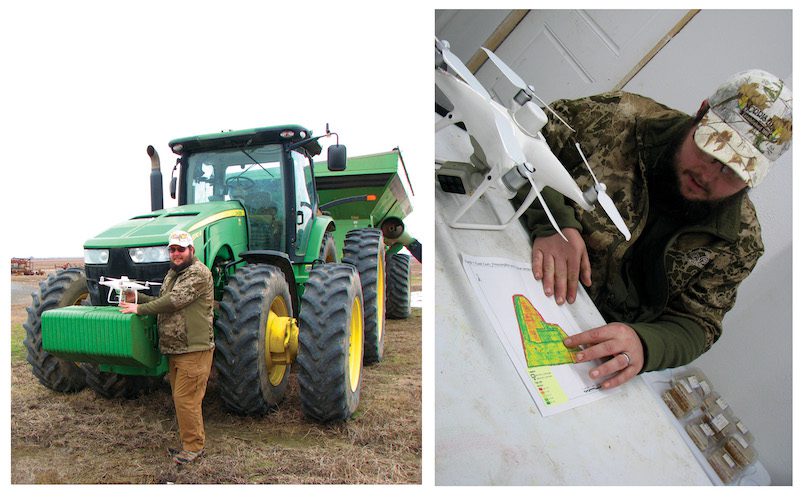
Morris utilizes “multiple inlet” technology developed by engineers with UADA. Water flows through Polytube, commonly called Polypipe. The tubing is rolled out flat along the edge of the field, and it expands like a balloon when filled with water. A computer program is used to determine the hole size and location for the most efficient use of water based on field elevation, row spacing, field shape, and row length. All this is data collected via drone. Morris stores his topical maps in a cloud service, uploads them to his cellphone and makes needed changes in irrigation flow, right from his cellphone.
Saving resources is at the forefront of Morris’ farming. His passion is saving water and minimizing inputs. He and his dad have implemented several methods of saving groundwater to avoid pumping water from wells, thereby saving water levels in the alluvial aquifer. They have built reservoirs to collect surface water, even ways to circulate irrigation water, commonly called tailwater recovery systems. Use of drones allows farmers to save water, one of our state’s natural resources, for other uses.
In short, Arkansas farmers have gone high tech to manage the business of producing food and fiber by developing site-specific management plans for their farms. The data that the systems provide includes field boundaries, elevations, row spacing, row length and plant stress. The information is used to make computer-aided decisions. There is a lot of science-based information needed to maximize farmer efforts.
What does all that mean to the average consumer? Drones and their application make it possible for farmers to produce a high-quality product with fewer strategically placed inputs and much less impact on our state’s natural resources, protecting water in both quality and quantity. That is a benefit to us all.
The future for advanced technology in farming is limitless. “As drones get cheaper and more available, they will likely become just another tool in every farmer’s tool chest,” Riley said. “We could see a future where farmers have their own little swarm of drones autonomously spot-treating their field for a certain weed. Hey, Alexa, release the swarm to weed the back 40!”